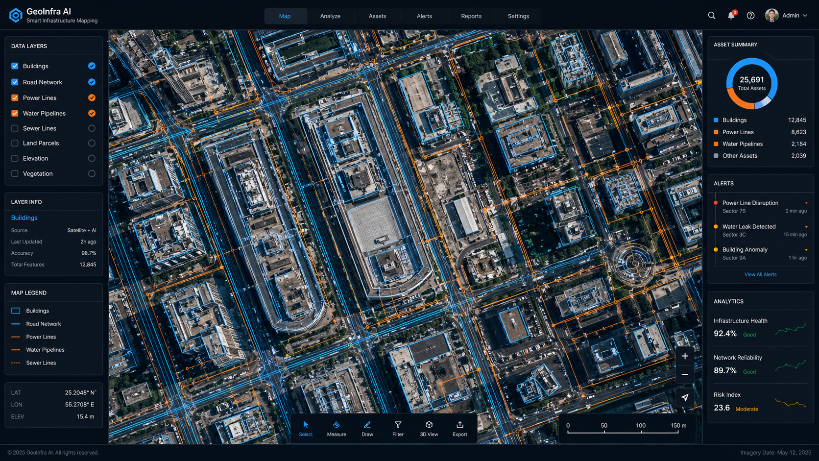
Our AI system analyzes satellite and aerial imagery to automatically detect, classify, and map physical infrastructure — without manual surveying or fieldwork.
Whether you need road networks, utility lines, or building footprints mapped across an entire city, our system delivers structured, queryable data at scale.
Feature List:
Automated detection from satellite & drone imagery
Classifies roads, buildings, utilities & more
City-scale to country-scale coverage
Delivered as GIS data, API, or dashboard
Continuously updated as infrastructure changes
Trusted by 20+ Companies
Applications
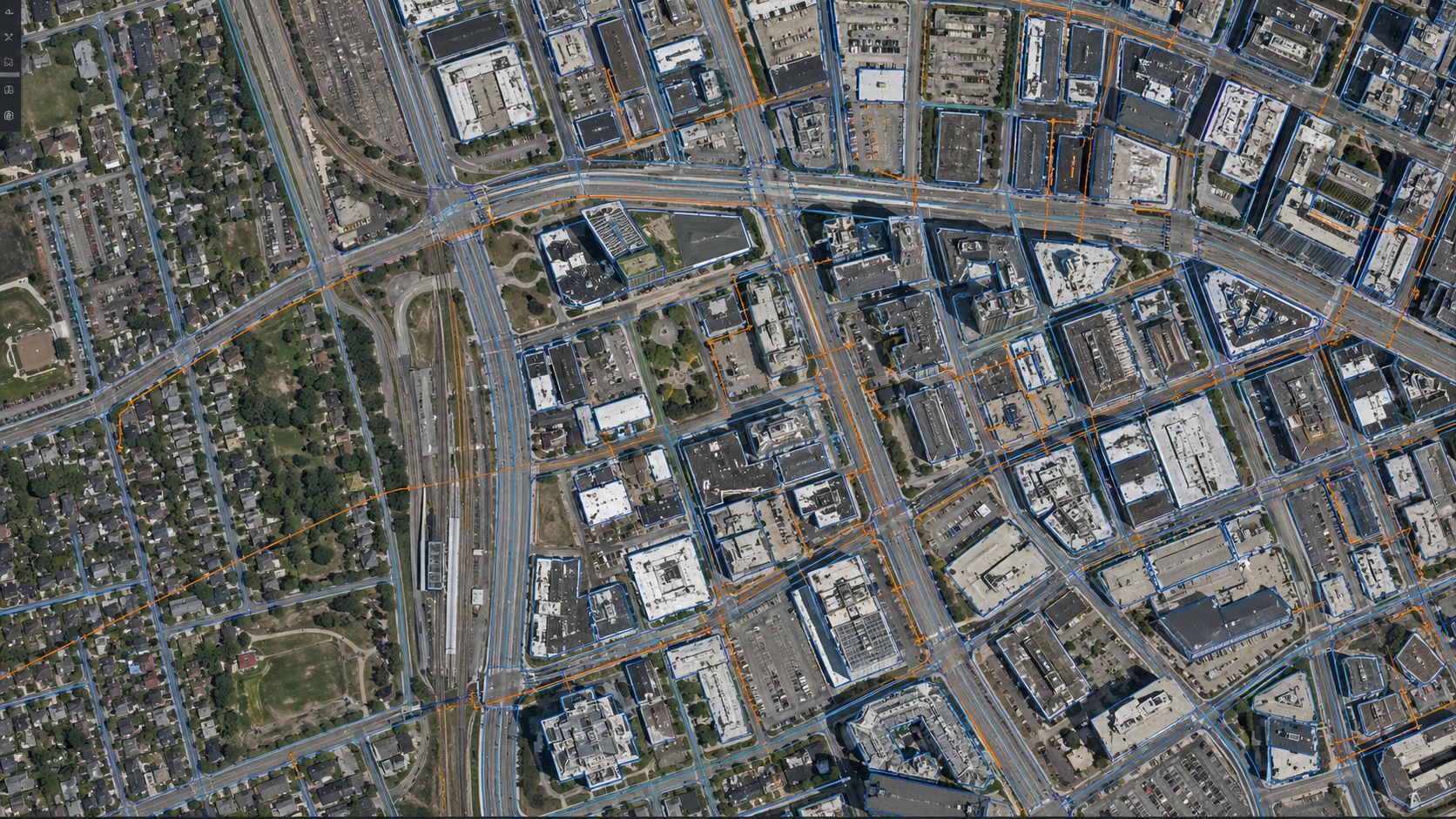
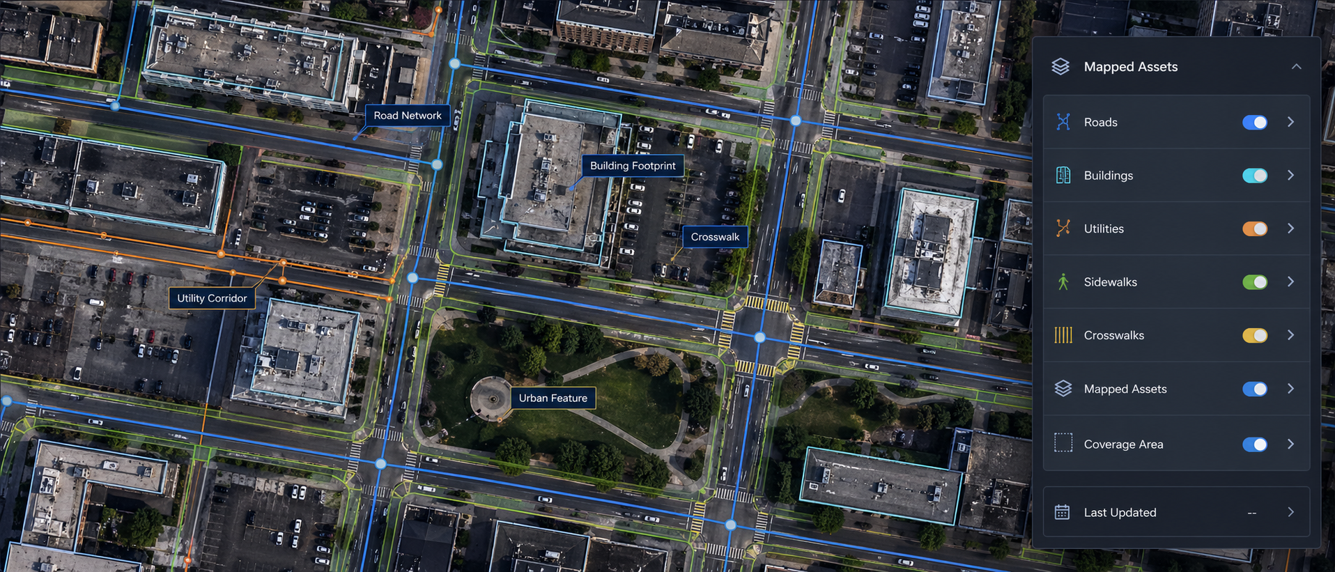
What We Can Detect & Map
From road networks to remote utilities — our AI maps any physical infrastructure from satellite imagery.
Road Networks
Detect and map road types, intersections, and coverage across any geography
Building Footprints
Identify and classify buildings by type, size, and density
Utility Lines
Map power lines, water pipelines, and telecom infrastructure
Bridges & Tunnels
Detect critical transport infrastructure and monitor structural changes
Urban Expansion
Track city growth, new construction zones, and land use changes over time
Remote Area Mapping
Map infrastructure in areas with no ground-level access
Value
What You Get
Accurate, AI-generated infrastructure data delivered directly to your team — ready to use.
Urban Planning
Empower city planners with accurate, up-to-date infrastructure maps for smarter decision-making and resource allocation.
Supply Chain & Logistics
Understand road connectivity and infrastructure gaps to optimize routes and reduce delivery costs.
Investment & Development
Identify high-growth zones and infrastructure-ready areas for real estate or development investment..
SEE HOW IT WORKS
Get a Qoute
Tell us about your project. We’ll be in touch soon.
Sign In
Sign Up
To get register with Edgec please send a request on below email, Thank you!