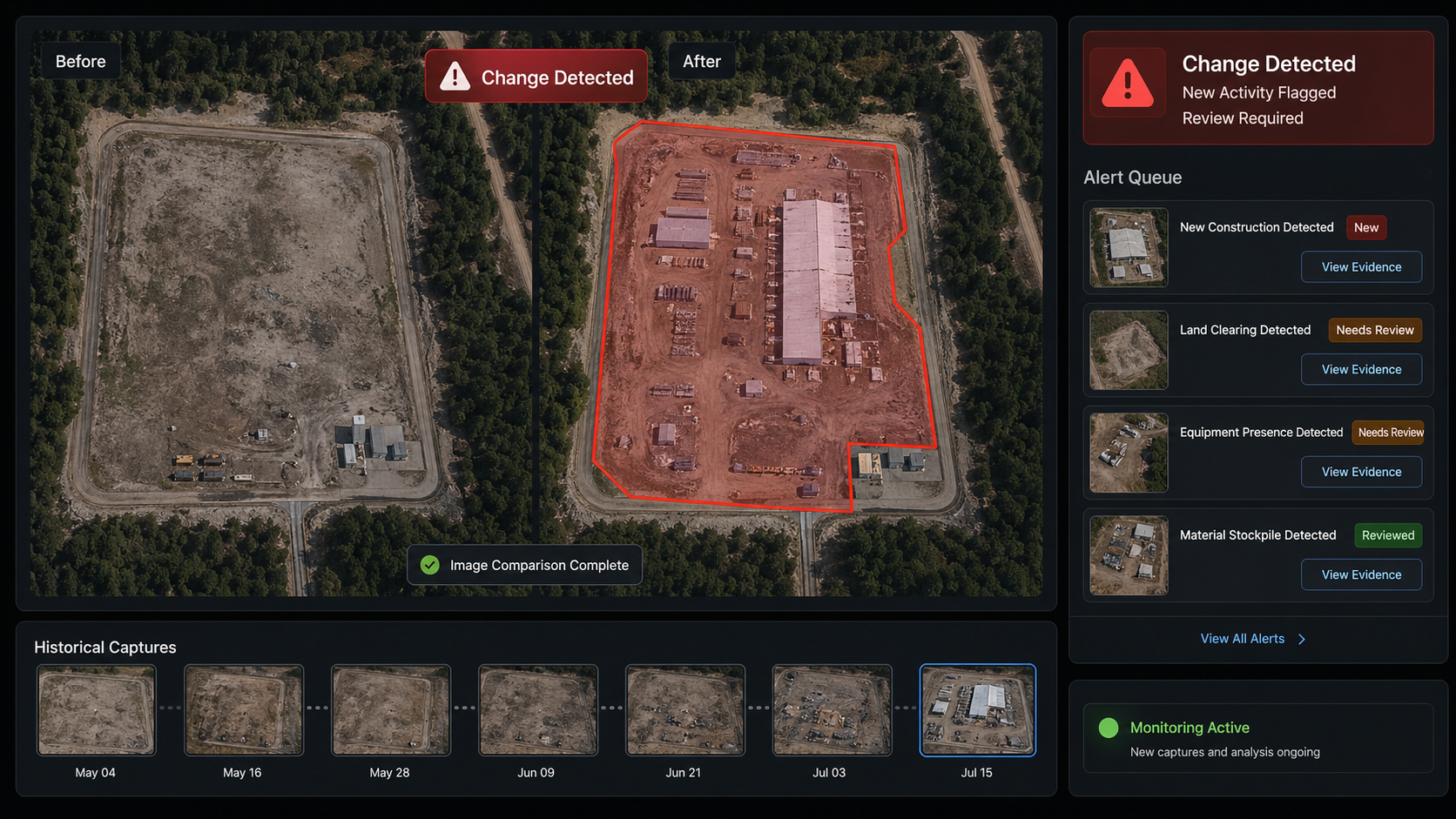
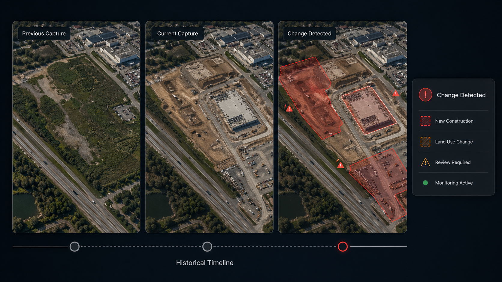
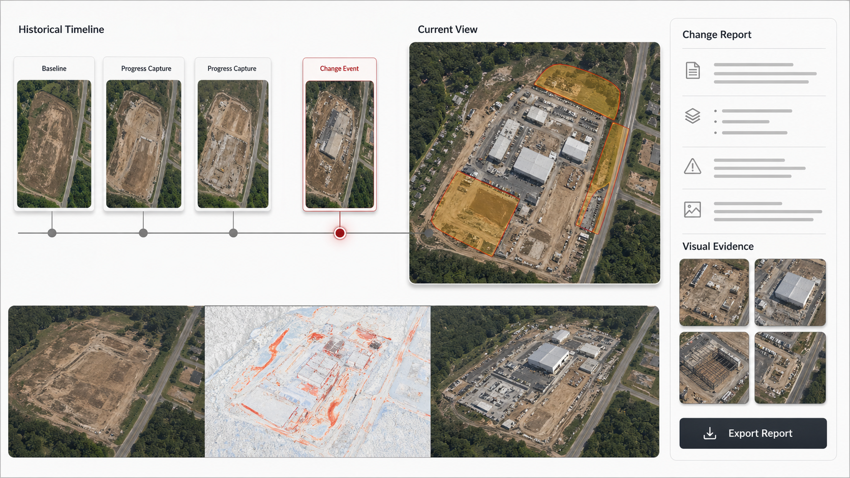
Our AI system continuously compares satellite or camera imagery over time to automatically detect and flag any meaningful changes — whether it’s new construction, environmental shifts, or unauthorized activity.
Instead of manually reviewing thousands of images, your team gets instant alerts the moment something changes on the ground.
Feature List:
Automated comparison of imagery over time
Detects construction, demolition & land use changes
Works with satellite, drone & CCTV footage
Real-time alerts when changes are detected
Historical change timeline & reporting
Trusted by 20+ Companies
Applications
What We Can Track & Detect
Track new builds, demolitions, and site progress over time
Construction Monitoring
Ask "How many solar panels are in this region?" and get instant answers
Environmental Changes
Detect deforestation, flooding, land degradation, and vegetation loss
Energy Asset Changes
Monitor pipeline expansions, rig activity shifts, and plant modifications
Unauthorized Activity
Flag illegal construction, encroachment, or land use violations
Urban Development
Track city expansion, new roads, and infrastructure growth
Remote Site Monitoring
Monitor hard-to-reach locations without physical site visits
Value
What You Get
Stay ahead of change — before it becomes a problem.
Instant Alerts
Get notified the moment a change is detected — no manual image review, no delays, no missed events.
Historical Timeline
Access a full visual history of any location — see exactly what changed, when, and how fast.
Cost Savings
Eliminate expensive field inspections and manual monitoring — let AI do the watching for you.
SEE HOW IT WORKS
Get a Qoute
Tell us about your project. We’ll be in touch soon.
Sign In
Sign Up
To get register with Edgec please send a request on below email, Thank you!