
Public Sector & Defense
Turn Public Infrastructure and Mission-Critical Visual Data Into Actionable Intelligence
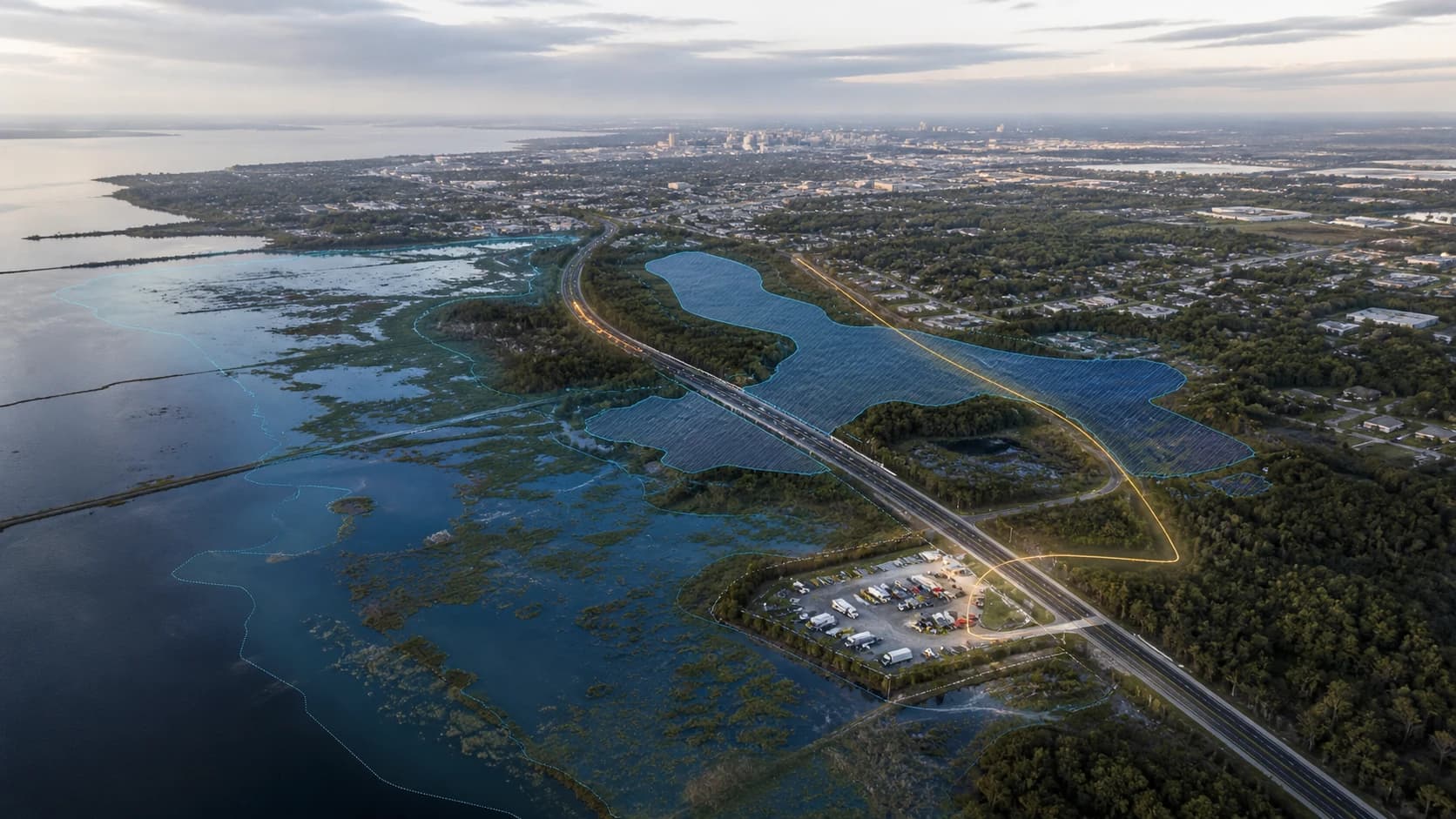
EDGE C helps government agencies, public infrastructure bodies, and defense organisations detect, map, monitor, and query assets and terrain using satellite imagery, aerial and drone imagery, CCTV and video feeds, GIS layers, inspection photos, and internal records.
From road and utility networks to installations, perimeters, border corridors, disaster zones, and restricted areas, we build AI systems that convert visual data into structured intelligence teams can act on — without replacing the systems you already run.
Build a clearer, faster, and more defensible picture of what is happening across the areas you are responsible for.
Industry Shift: Public Sector Decisions Are Becoming Evidence-Driven
Public agencies and defense organisations are responsible for enormous physical footprints — road and rail networks, utilities, water systems, public buildings, coastlines, borders, and installations — and they are expected to account for all of it with shrinking budgets and stretched teams.
At the same time the amount of visual data available has grown far beyond what any team can review by hand. Commercial satellite revisit rates have collapsed from weeks to days, drone survey costs have fallen sharply, and most agencies already hold years of aerial imagery, inspection photography, and camera footage in archives nobody has time to look through.
The constraint is no longer access to imagery. It is the capacity to turn imagery into something a decision can be defended with.
That matters more in the public sector than almost anywhere else, because decisions have to survive scrutiny. Budget allocations, enforcement actions, planning approvals, and incident responses all need an evidence trail — a record of what was observed, where, when, and with what confidence.
Core Challenge: Wide Areas, Sensitive Assets, Limited Visibility
Public infrastructure and mission environments are difficult to monitor because they are geographically dispersed, continuously changing, and frequently hard or unsafe to reach on the ground.
Most organisations still depend on scheduled physical inspections, disconnected GIS systems, manual photo review, and reporting cycles measured in weeks. The result is a picture of the ground that is always somewhat out of date.
Common challenges include:
- Maintaining an accurate inventory of public assets across a large jurisdiction
- Detecting unauthorised construction, encroachment, or land use change early enough to act
- Reviewing thousands of aerial, drone, satellite, or CCTV images manually
- Keeping GIS layers and asset registers current as conditions change on the ground
- Assessing damage quickly after storms, flooding, fire, or other incidents
- Monitoring perimeters, corridors, and restricted areas across wide, remote geographies
- Producing consistent, auditable evidence for planning, enforcement, and reporting
Why This Matters Now
Three pressures are converging on public sector and defense teams at the same time: ageing infrastructure that needs continuous assessment, climate-driven events that demand faster damage response, and public expectations of transparency that assume near real-time answers.
Agencies that continue to rely only on scheduled inspection cycles and manual review risk:
- Discovering asset degradation and safety issues later than they should
- Slow, uneven damage assessment when a rapid response window matters most
- Asset registers and GIS layers that no longer match conditions on the ground
- Encroachment and unauthorised activity that goes unnoticed until it is expensive to reverse
- Decisions that are difficult to defend because the supporting evidence is inconsistent
- Inspection and survey spending concentrated on locations that did not need attention
The organisations that stay ahead are the ones treating their imagery archive as a queryable asset rather than a storage cost.
How EDGE C Helps
EDGE C builds AI-powered visual intelligence systems for public sector and defense organisations.
We help teams convert raw visual and geospatial data into structured, searchable, and auditable intelligence. Instead of manually reviewing imagery and inspection photography, your teams use AI systems to detect objects, classify assets, monitor change over time, generate reports, trigger alerts, and query the results directly.
EDGE C can help you build systems that:
- Detect and map public infrastructure from satellite, aerial, drone, or inspection imagery
- Convert detections into GIS-ready datasets that plug into existing systems
- Monitor change across jurisdictions, corridors, installations, and restricted areas
- Identify encroachment, unauthorised construction, damage, erosion, flooding, or vegetation risk
- Deliver dashboards, APIs, alerts, reports, and natural-language query tools
- Attach location, timestamp, and confidence to every detection so findings are auditable
EDGE C does not need to own proprietary datasets or sell satellite imagery. We build the intelligence layer on top of your own data, third-party data, or publicly available sources — and we work within the deployment constraints your environment requires.
Data Sources EDGE C Can Work With
For public sector and defense work, relevant data sources may include:
- Satellite imagery
- Aerial and orthophoto surveys
- Drone imagery
- CCTV and video feeds
- GIS layers and cadastral data
- Inspection photography
- Thermal and multi-spectral imagery
- Historical imagery archives
- Asset registers and maintenance records
- Terrain and elevation models
- Environmental and hazard zone overlays
- Incident and field reports
What EDGE C Can Detect & Monitor
Public Infrastructure
- Road and rail networks
- Bridges and culverts
- Public buildings and facilities
- Water and drainage infrastructure
- Power and utility corridors
- Ports, airfields, and logistics hubs
- Coastal and flood defences
Sites, Perimeters & Corridors
- Installation and facility boundaries
- Perimeter integrity and access points
- Vehicle and equipment presence
- Activity levels across a site over time
- Border and corridor monitoring
- Restricted or exclusion zones
Land Use & Change
- Unauthorised construction and encroachment
- New development and site expansion
- Land clearance and excavation
- Informal settlement growth
- Changes to protected or designated land
Hazard, Damage & Environmental Risk
- Post-event damage assessment
- Flooding and water accumulation
- Erosion and land movement
- Fire scarring and vegetation loss
- Vegetation encroaching on infrastructure
- Assets sitting inside high-risk zones
High-Value Use Cases
1. Public Asset Inventory and Mapping
Build and maintain a current inventory of public infrastructure across a jurisdiction, detected from imagery rather than assembled by hand.
Business value: more complete asset visibility, better GIS accuracy, and far less manual mapping effort.
2. Encroachment and Unauthorised Development Detection
Compare current imagery against historical baselines and designated land boundaries to flag construction and land use that should not be there.
Business value: earlier intervention, when enforcement is still straightforward and inexpensive.
3. Rapid Post-Event Damage Assessment
After flooding, storms, or fire, process imagery across the affected area to identify damaged infrastructure and prioritise response.
Business value: faster, more even assessment across a whole affected region instead of the areas teams reach first.
4. Perimeter and Corridor Monitoring
Monitor installation perimeters, border corridors, and restricted areas for activity and change, across geographies too large to patrol continuously.
Business value: consistent coverage of remote areas without proportional increases in headcount.
5. Inspection Prioritisation
Use detected condition indicators to decide which assets actually warrant a physical inspection this cycle.
Business value: inspection budget concentrated where it changes an outcome.
6. Planning and Compliance Evidence
Produce consistent, timestamped, location-tagged visual evidence to support planning decisions, enforcement, and public reporting.
Business value: decisions that are easier to explain, defend, and audit.
7. Historical Imagery Intelligence
Process existing imagery archives to reconstruct how an area changed over years, rather than only from the point monitoring began.
Business value: turns an archive that currently costs money to store into an evidence base.
Queryable Intelligence
EDGE C can help public sector and defense teams ask natural-language questions across visual and geospatial data.
Example queries include:
- “Show all bridges detected in this district and when each was last imaged.”
- “Which public buildings sit inside the current flood-risk zone?”
- “What construction appeared inside this protected boundary in the last 12 months?”
- “Which road segments show surface damage after last month’s storm?”
- “Where has vegetation grown within clearance distance of power lines?”
- “Which sites along this corridor show a change in activity since the last review?”
- “Show every detection in this area with a confidence above 90%.”
Instead of searching folders, static maps, and disconnected reports, teams query a structured intelligence layer built from their own imagery and records.
How It Works
Public sector data sources → AI detection and analysis → structured intelligence → dashboards, APIs, alerts, reports, and query tools.
1. Data Ingestion
We ingest the sources you already hold — satellite, aerial, drone, CCTV, GIS layers, inspection photography, historical archives, and asset records.
2. AI Detection & Classification
Computer vision models detect, classify, and tag the assets, features, risks, and changes that matter to your mandate.
3. Structured Dataset Creation
Detections become structured records carrying location, category, confidence, timestamp, and asset references — the basis of an auditable evidence trail.
4. Monitoring & Change Detection
The system compares current and historical data to surface new activity, missing assets, damage, encroachment, and environmental change.
5. Delivery Layer
Findings reach your teams through dashboards, GIS-ready exports, APIs, alerts, scheduled reports, or natural-language queries — whichever fits how they already work.
What You Can Build With EDGE C
EDGE C can help build practical AI systems and intelligence tools for public sector and defense teams, including:
- Public asset detection and inventory systems
- Infrastructure condition monitoring dashboards
- GIS-ready detection datasets
- Change detection and encroachment workflows
- Rapid damage assessment pipelines
- Perimeter and corridor monitoring tools
- APIs for asset and detection data
- Alerting systems
- Automated reporting for oversight and compliance
- Natural-language query tools
- Decision-support and prioritisation systems
- Field validation workflows
Build the Intelligence Layer Your Mandate Requires
Public sector and defense organisations already hold the imagery, the GIS layers, and the records. The step that has been missing is the layer that turns them into current, queryable, auditable intelligence.
EDGE C builds AI systems that connect imagery, maps, inspections, and operational records into tools your teams can actually use — and evidence your decisions can stand on.
Related Solutions
Get started
Book a call with us
Tell us what data you already have. We'll show you what an intelligence layer on top of it looks like.
- A 30-minute call, no prep needed on your side.
- Bring the data you already have — imagery, feeds, GIS layers, records.
- You leave with a concrete view of what an intelligence layer on top of it looks like.
Prefer to reach us directly?
Choose a time
The usual starting point. Walk us through your data and goals, and leave with a concrete view of what's buildable.
Loading available times…
Book a meeting on CalendlyTrouble booking? Open the scheduler in a new tab.